Saturday, December 14, 2019

Is the River Trail Safe to Share, Vol II? Or, Where Is The Eastern End?

In the last post, I discussed the Santa Fe River Trail, covering the segment from St. Francis SW to Siler Road. Today, after putting a pair of Schalbe Marathon Plus tires on the Long Haul Trucker and having a former BTAC member gently remind me to look at the eastern end of the River Trail, I  took a look at the trail from St. Francis Drive towards Downtown.

Mounting those tires was indeed a bit of a marathon. They were so tight on the rims that I ended up using motorcycle tire levers to mount them. My buddy Pat O'Brien concurs.  If I ever flat on the road, I think I might just call a cab.

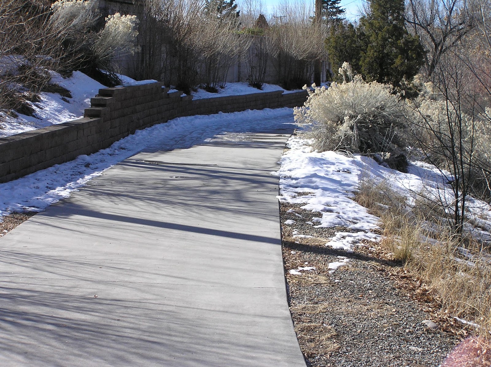
Back to the trail. I hopped on it at St. Francis. For the most part the trail is plenty wide and the sight lines are excellent.

Between St. Francis and Campo, looking W.

Between St. Francis and Campo, looking E.

 However, when you are passing Campo you start seeing suggestions that the trail will soon end. But where?

Sensing impending end of trail, I kept riding eastward. Finally, when I was approaching Galisteo, the trail precipitously narrows to about five and a half feet and there is a sign indicating cyclists can take the full lane. Presumably, since at this point the trail is not of minimal AASHTO width to share and the sign indicates we can take the lane, this is the end of the multiuse portion of the River Trail. At that narrow width, I would not attempt to share it in a busy downtown area.

I think the City should put up a sign or signs indicating that the multiuse portion of the River Trail ends where the sidepath narrows below AASHTO minimum.  I wonder if this is the area where the older gentleman who spoke at a recent BTAC meeting felt genuinely rattled sharing what at this point is a sidewalk with cyclists.Not sure, but at any rate, we ought to recognize that at this point the sidepath is actually a sidewalk.

Of course it is legal to ride on a sidewalk unless there is signage posted to the contrary as per 12-8-15 ("Riding on Sidewalks") of the Santa Fe Uniform Traffic Ordinances, (downloadable pdf here) and I didn't see any signage as required telling cyclists not to ride on the sidewalk. That said, I would think, as an LCI, that one's underlying assumptions would change just a little bit. Its now a sidewalk rather than a multiuse trail facility. Be more careful as there is less space to share and you therefore will not be able to give other users as much distance from yourself when sharing that space. 

Personally, I see no reason why a competent adult cyclist should be riding on the "sidewalk" rather than on E. Alameda. Traffic is manageable. I ride it all the time as it is part of one of my frequent short loops. My personal view is that once the sidepath narrows to below AASHTO minimum, it should be reserved for pedestrians in all but a few cases (riding with children, an elderly person who can't risk any possible contact with a motor vehicle, etc.). In those cases, RIDE WITH CAUTION AND WITH DUE RESPECT TO PEDESTRIANS.

Vandalized sign at W. Alameda and Campo
 indicating trail ends soon,

Wayfaring at Campo

Approaching Galisteo from the West, 
you see the sidepath narrow and are invited to take the lane.
Maybe we should add "multiuse trail ends here"

Just W. of Galisteo, the sidepath narrows 
to sub-AASHTO width. End of the (multiuse) Trail?
Long Haul Trucker with difficult to mount Schwalbe Marathon Plus tires 
is ~65 inches long (five feet five inches) for scale,
so "walkway" is about five and a half feet.


Monday, December 2, 2019

Is the River Trail Safe to Share?

Yield to Peds. Good idea


Its a pretty place, and very popular.
At a recent Bicycle and Trails Advisory Committee (BTAC) meeting in Santa Fe, an older gentleman (and I don't mean that disparagingly, given my advance into geezerhood) who walks the River Trail was adamant that sharing the trail with bicyclists is not safe. Today, I took a short ride from the bridge crossing at the Gonzales School to the current end at Siler to think about it. Yes, it is safe, but only if everyone does their part to make it safe.

There are several issues to consider. Human conduct, engineering, topography, and maintenance. All come into play.

As far as topography, the trail follows the river, which is why its called the River Trail. Rivers need a gradient and this one is no exception. Riding a pretty mundane bike at a pretty mellow level of effort, I was able to easily push 15-22 mph riding downhill to the Southwest. Riding back to the Northeast, I was trying to maintain a moderately easy level of effort and chugging along at about 10 mph. So my suspicion is that downslope cyclists probably worry people a little more than upslope ones.
The bicycle

As far as design. The trail follows the river in some sort of easement. The trail width is eight to nine feet, approximately (I forgot my tape measure so used paces). The section from  Camino Alire to Ricardo Road is about eight feet. That is AASHTO minimum and a little worrisome for a busy multiuse trail. NE and SW of that the trail is about nine feet wide. I'll go measure it again to be sure.

In addition, the section of trail from Gonzales School to Ricardo Road has several sharp curves with limited sight distance and at Camino Alire, a fast downhill beneath the roadway bridge. This requires everyone to be on their best behavior lest someone go around a curve or down a hill too fast and get a nasty surprise. I show some of these below. This section also happens to have multiple parks and recreational fields, a senior center, and three bridges crossing the river to Casa Solana, so it is often quite busy. The combination of sharp curves and fast downhill cyclists coupled with meandering pedestrians and dog walkers can make for a hazard unless there is cooperation.
Sharp, limited sight distance curve needing signage

 Finally, maintenance. In addition to the widespread presence of ice, the trail is festooned with chamisa, some growing to be quite substantial and in addition to narrowing the trail, can obscure other users. I'm not sure what the policy is for the city to clear ice and snow from multiuse trails but strongly urge the city to look into this before someone is badly hurt and sues the city, and in addition, trim back the foliage so it doesn't create a hazard by obstructing the trail and screening users from each other.

As far as what bicyclists should do? Keep speed under control, stay alert, yield to and ride carefully around other users, esp. pedestrians who can turn more quickly than a bicyclist, and put a bell on your bike to alert others. As far as additional things the city can do? In addition to the Yield to Peds sign, I would suggest some SLOW, SHARP CURVES and perhaps SLOW, STEEP INCLINE signage to remind people what should be obvious. And trim the chamisa back so it is not impinging on the trail.

Fast downhill under Alire

 There is no one silver bullet here, just a lot of lead (or perhaps copper, to be environmentally correct) ones. The city should provide signage and maintenance and the cyclist should provide due care and common sense. The fashionable words today are to protect "vulnerable users" on our roads. Well, on a trail, an elderly gentleman is a vulnerable user. Ask one of my former Univ of Hawaii colleagues who accidentally knocked down an elderly lady who was walking with traffic as my colleague rode his bike down a mountain road. She hit her head on the pavement and died a few days later of a brain injury. Think about that next time you don't worry about trail safety.
Curve, ice, and chamisa screening

Massive chamisa obscuring a walker
About a hundred yards of glare ice
Nice bell purchased at REI
SW portion of trail has great sight lines

Thursday, November 14, 2019

Trial Date Set for Assault on Seniors on Bikes Near Santa Fe


Just saw this on the Seniors on Bikes web page. "I was called today by the district court regarding the attack on the SOB’s 20 months ago where 3 of us were injured.  The final status hearing was held yesterday and no move to again postpone the process was accepted, so now, we proceed to trial. ..."

For the full post, go to the SOB site. I don't want to poach their content.

I think this story in the New Mexican is about the case being discussed but if anyone knows better, send me a comment and a link.

Be careful out there.

Monday, October 28, 2019

The Only Two Sure Things...


 ‘Tis impossible to be sure of any thing but Death and Taxes,” from Christopher Bullock, The Cobler of Preston (1716).

Going for an eye exam today, I got a chuckle out of the two businesses sitting next to each other near my eye doc and thought of that famous quote. Getting through the eye exam, the good news is that my eyes still work. Getting home from the exam and answering the phone was not quite so lovely an experience.

A friend of mine who recently retired to enjoy those golden years unencumbered by the nine to five drudgery found said friend in a foreign hospital with a serious life threatening illness. I guess the bottom line is, enjoy it while you have it and put some of the bullshit aside. In other words, go ride yer bikes.Tomorrow it may rain, metaphorically or literally.


Sunday, September 22, 2019

Last Summer ride, and a Tour de Gated Communities

Near the top of Gonzales Rd,
 looking at the aspen changing

Today was the last day of summer and was a Sunday, so clearly a reason for a bike ride in the lovely last day of summer weather. I had wanted to scope out another loop so that's what I did. Whether to call it Tour de Gated Communities or Tour de Undertaxed and Over-privileged neighborhoods is up to one's prevailing sarcasm, but a lot of the ride was over in Las Campanas, the upscale and exclusive community west of the City Indifferent. I did pass quite a few gated communities. The rolling ride ended up breaking my 20 mile estimate, coming in at a 23.5 mile loop but that's a fine point.

From Casa Solana I headed west on Camino de las Crucitas, veered to the right onto Buckman Rd and then another veer right onto Camino de las Montoyas. Crossing NM 599 on Montoyas one goes north to the t-intersection and then turns left onto Tano Road. Take Tano to the pavement end and turn left onto Tano West. Take Tano W down the fast descent and brake to turn L onto Sundance Dr. Take Sundance to the end and do a quick left on Palantine and quick R. onto Luvia de Oro. Luvia merges into Fin de Sendero, which takes you due south to Camino La Tierra. Turn right and go about a mile and a half. At this point, Camino la Tierra veers left and Las Campanas Dr. veers right. Stay to the right. The road loops to the left and through an underpass and heads southwest. Its a mild downhill and very pretty with great vistas. After about four miles, turn left onto Caja del Rio road, which heads south and then ends at a T at NM 599 after about four miles. Take a left at the T and head north, enjoying about a mile of horrible chipseal with a narrow shoulder to the double roundabouts at South Meadow. From there you can either take the frontage road or cross the highway onto W. Alameda to head north back to Santa Fe. I took Alameda and enjoyed more chipseal. Another four miles on W. Alameda heading NE gets you back to Casa Solana.

To get 30 miles I continued on W. Alameda through the city center and climbed Gonzales Road, crossed Hyde Park, looped around Paseo del Sur to Vallecita and back to Bishops Lodge, turned left, made the right onto Paseo del Peralta, and back home. Nice ride. A right onto Bishops Lodge with a northern loop to Tesuque and back down on Old Taos Hwy would get you about forty miles.


Sunday, September 8, 2019

Broken Roads and "Mountain Bikes"

I wanted to do a little experiment and see if a Shimano 9 spd XT derailleur matched to a spare 11-32 casette would synch with an old set of Dura Ace 9 Spd STI in order to get me up Hyde Park Road without my eyes bulging out of their sockets. Seems to work really well. Now, I have to see if it works with my 12-27 and 12-28 cassettes. Also want to ditch the 11 cog for a 12. I don't go that fast.

STI Dura Ace Shifters

Compact crank, XT Derailleur and 11-32 cassette.

The whole rig at 13 Mile Rock (a granite boulder 13 miles from the house near the top)
Don't ever take climbing for granite...
Meanwhile, the road needs some work since the monsoon rains washed out a lot of the mountain next to the road and even washed out the road edges. I dropped my front wheel into a collapsed edge a couple weeks ago (yeah, I know, "watch where you are going, dummy") and wrenched my back, which was part of the reason to drop the gear ratios. But collapsed road edges force riders farther into the lane and are a hazard for everybody. I emailed the District 5 DoT engineer but no response. Be careful up there and call the Dist. 5 engineer. After all, we got all that surplus state money from the Permian Basin production, right?


That's how deep some of the drops are up there. Yes, that is the quick release at road level.

More roadside hazard

I was hoping this was a sign that the state was fixing the roads but a park ranger said it was work they were doing on their driveways